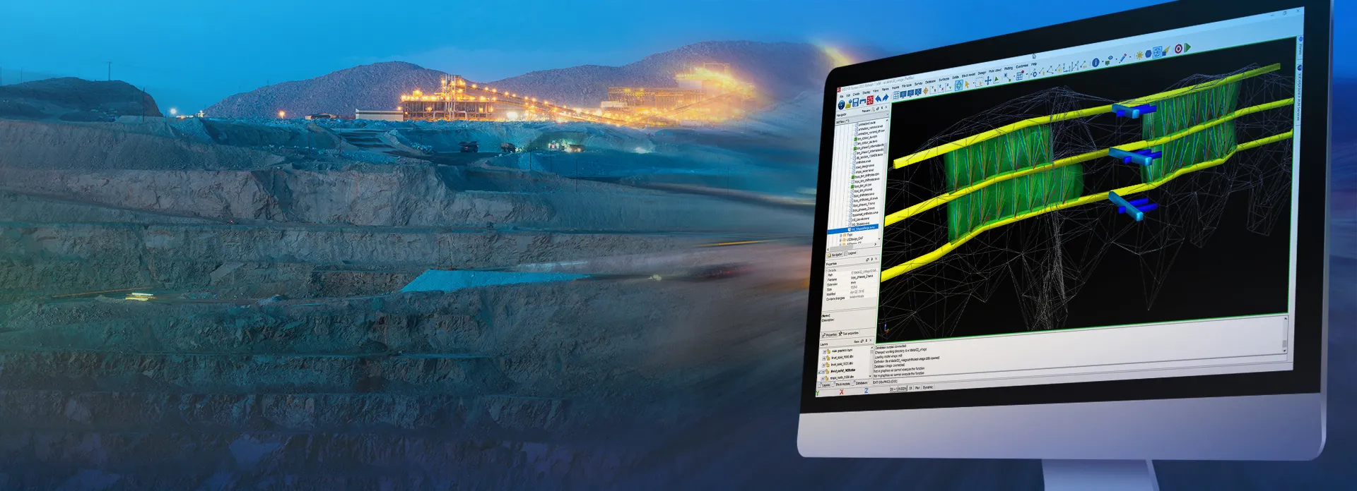
GEOVIA Surpac
Comprehensive Mine Planning and Geological Modelling Software
Quantify, Evaluate, and Maximize the Orebody
GEOVIA Surpac provides mining companies with the powerful, reliable, and customizable 3D mine planning and geological modelling software they need to deliver advanced drillhole-data management, perform rigorous statistical and geostatistical analyses, and develop comprehensive resource models, mine designs, and mine plans for either open pit or underground operations.
With Surpac, geologists can quantify and evaluate the physical characteristics of a deposit, even with limited information. Engineers can visualize mine designs and plans that maximize ore recovery while complying with project constraints. Mine production teams can integrate vast amounts of data to determine the best way to extract reserves.
GEOVIA Surpac Roles
Discover the world’s most comprehensive geology and mine planning role-based portfolio for surface and underground mining.
- GEOVIA Block Modeler
- GEOVIA Sectional Geology Modeler
- GEOVIA Structural Geology Analyst
- GEOVIA Mine Contributor
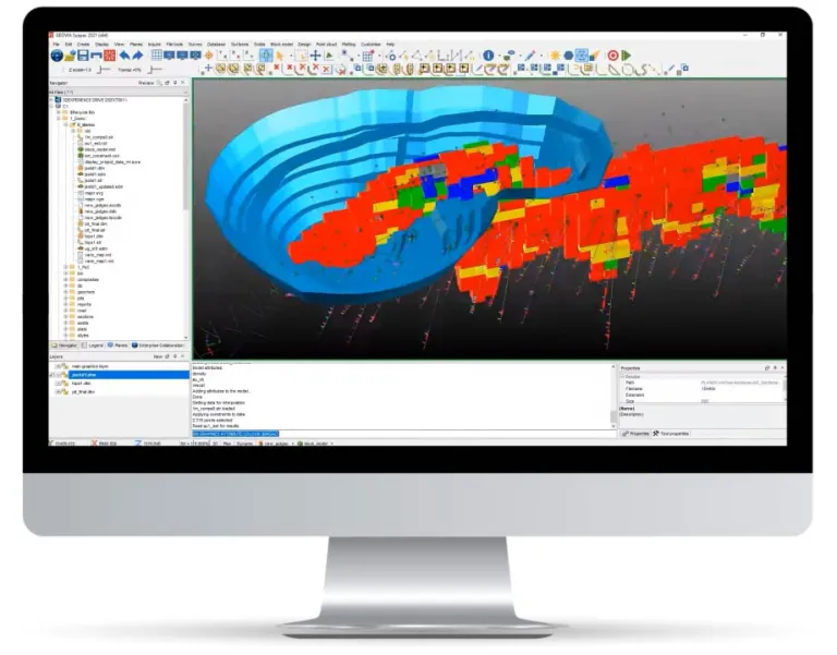
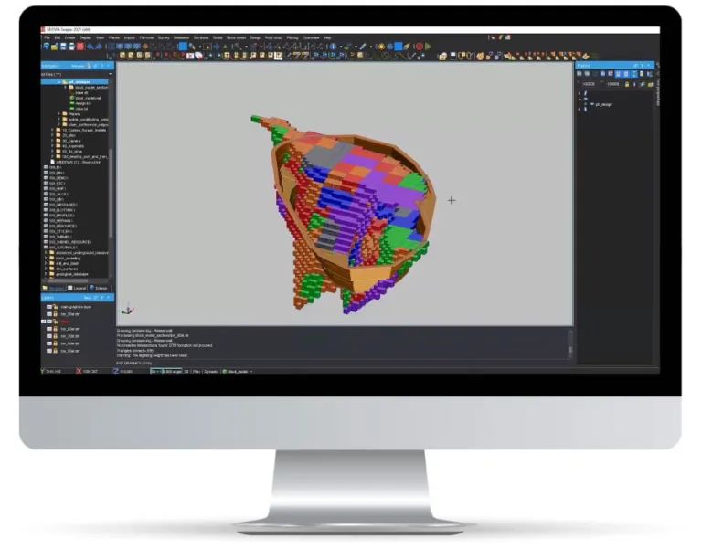
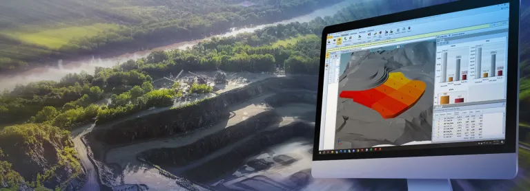
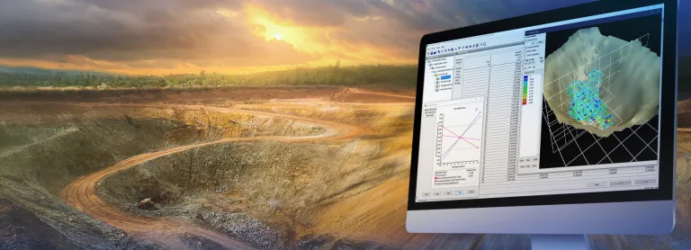
GEOVIA Block Modeler
Analyze the spatial variability of earth characteristics and create regularized volumetric models of the combined set of characteristics. Perform bench based block grade control calculations for open cut operations.
- Calculate volume and quality of materials within extents of an area under investigation
- Create reports of any geological object according to international standards
- Generate volumetric block models & perform geostatistical analysis
- Evaluate mineral resources
- Produce outputs for regulatory reports and investment feasibility decisions
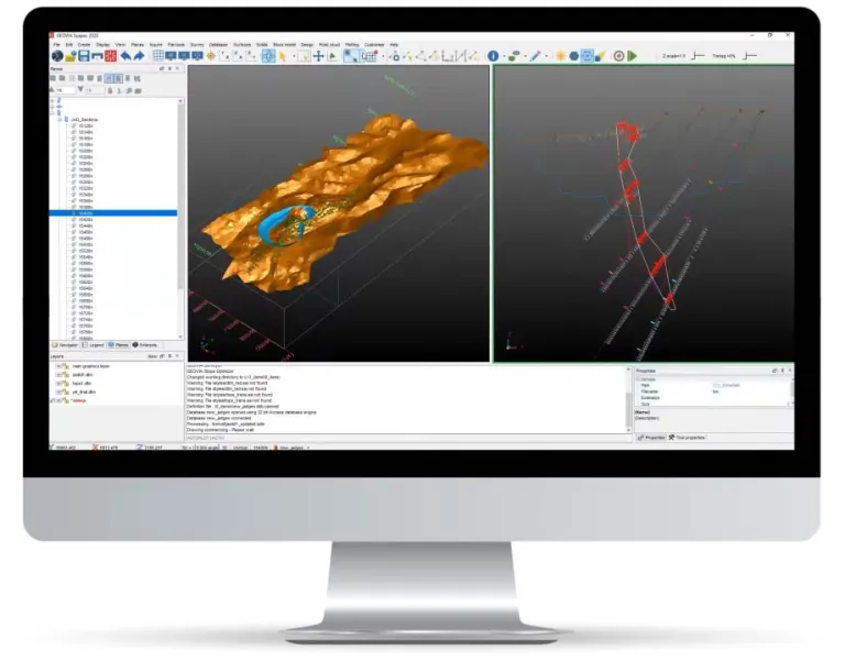
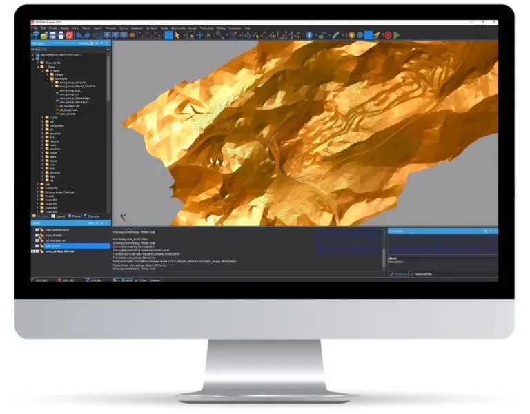
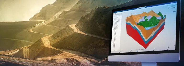
GEOVIA Sectional Geology Modeler
Visualize and analyze drill holes and other surface samples and measurements. Perform compositing, sectional geological modeling, meshing and gridding of surface and subsurface geology objects, and bench based grade control calculations for open cut operations.
- Input, access and output various types of geological data
- Select, constrain, view and interpret geological data
- Create geological, structural and domain models
- Conduct face mapping from point cloud and photogrammetric meshes
- Calculate volumes and model quality of materials within area under investigation
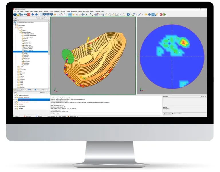
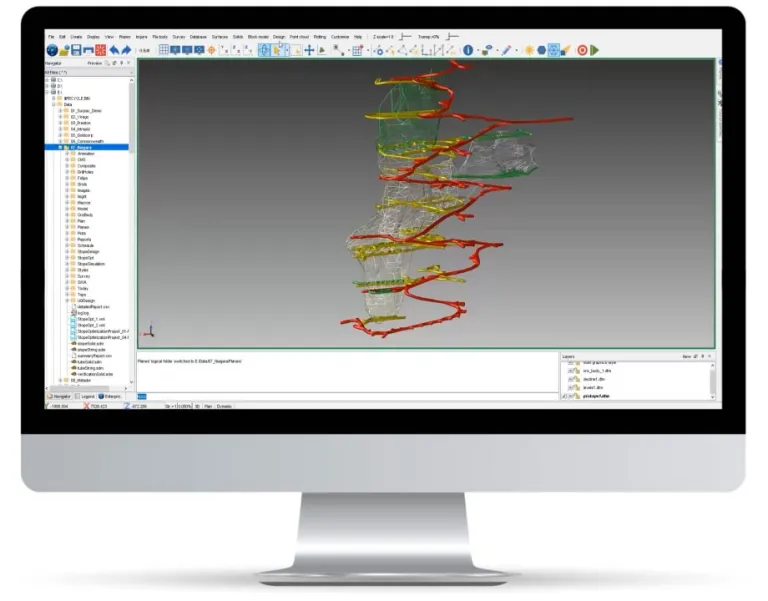
GEOVIA Structural Geology Analyst
A comprehensive set of visualization and analysis tools for any kind of oriented data such as drill holes, point clouds and textured meshes.
- Extract and visualize orientations directly from drill holes, points and block models
- Analyze surface gradients
- Visually create planes from point clouds or textured meshes and analyze them on a stereographic projection
- Perform structural trend analysis in large and complex datasets
- Perform rapid structural analysis of point cloud and photogrammetry dataset
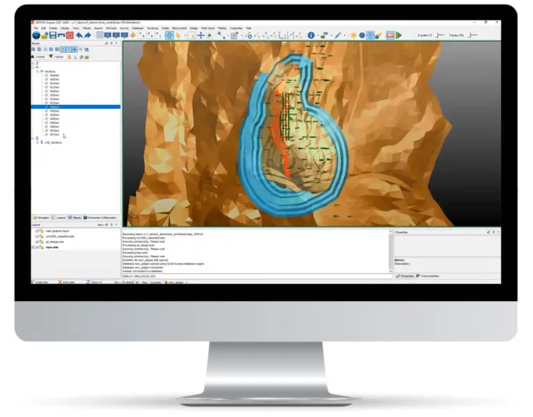
GEOVIA Mine Contributor
All the tools you need to visualize and collaborate with other mine planners and geologists on enterprise mining data.
- Input, access and output mining geological and engineering data
- Select, constrain and view exploration data and mine information
- Model and create complex surface and solids representing mining data
- Create point and line data with comprehensive CAD toolset
- Import and manage massive point cloud data, clean and generate surface meshes, and report on volumes
- Automate workflows using powerful scripting capabilities with ability to record and playback
- Support very large point cloud datasets
- Enable reports, plans and visual outputs for production crews and other downstream uses
- Languages supported: English, Chinese, Russian, Spanish, and French
- GEOVIA Surveyor
- GEOVIA Mine Designer
- GEOVIA Drill and Blast Designer
- GEOVIA Stope Optimizer
GEOVIA Surveyor
Generate the daily survey requirements for the mine site by integrating and processing survey data from CMS, GPS and other traditional survey instrumentation, and update as-built mine geometry from reduced survey data.
- Calculate total material handled, rehandled or filled
- Set out or delineate locations and boundaries
- Ensure compliance with survey‑related regulation or legislation
- Publish the following measured survey data for use in the mining production process:
- Survey control stations and reduced pickups
- Mining infrastructure (buildings, roads, processing plants, etc.)
- As-built maps of the mine, compared to the design
- Monthly volumes mined/filled and broken (reconciliation)
GEOVIA Mine Designer
Convert strategic mine plans into practical mine designs including mine surfaces, ramps, tunnels, haul roads, waste dump, whilst also producing reserve reports and mine plans. Encompasses all design horizons including daily, weekly, monthly and long term.
- Design bench, berm and ramps constraints for surface mining
- Design stopes, tunnels, ramps and shafts for underground mining
- Design waste dumps, tailing dams and haul roads for mining infrastructure
- Incorporate geotechnical constraints such as slope stability
- Integrate geology for reserve reporting of grade, tonnes and volumes
- Produce mine plans and visual outputs for communication with production crews
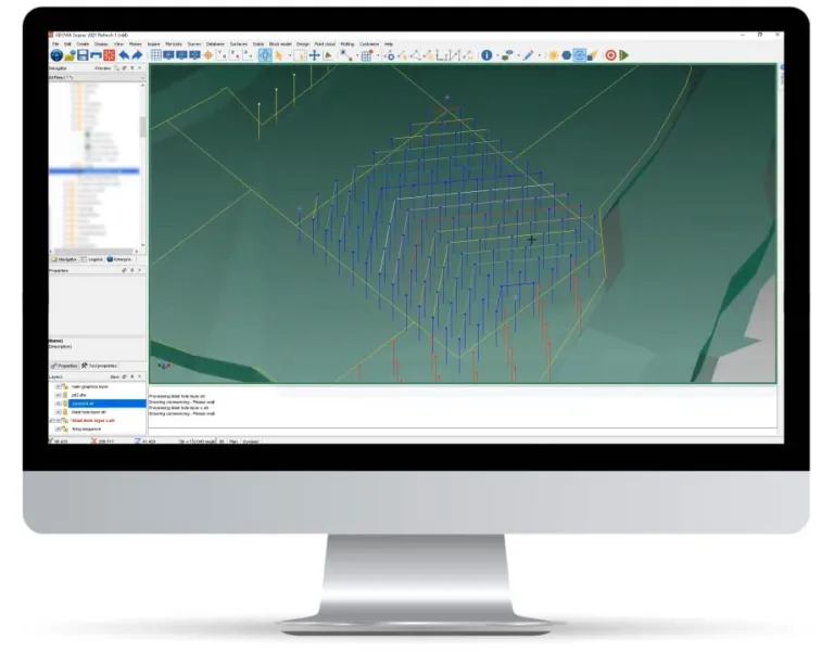
GEOVIA Drill and Blast Designer
Design and plan suitable blast patterns to ensure monthly production tonnage targets are met, factoring in safety, materials and costs associated while looking for ways to reduce costs and improve performance.
- Surface mining - efficient design of bench blast patterns considering blast hole layout, load and charging, detonation sequence and blast solids
- Underground mining - efficient design of underground ring or drill & blast patterns considering blast hole layout, load & charging, detonation sequence and drill rig parameters
- Produce reports, plans and visual outputs for production crews and required reporting for costs and volumetrics against targets
GEOVIA Stope Optimizer
Create and consider multiple possible stope designs to determine the optimal design that meets a set of strategic objectives, often tied to extracting the highest possible economic value from a deposit.
- Generate optimum stope designs for a range of underground mining methods
- Produce stope inventories from block models that spatially represent the location of mineralization
- Generate stope designs that maximize recovered resource value above cut-off grade
- Create practical mining parameters such as minimum and maximum mining width, anticipated wall dilutions, minimum and maximum wall angles and many other factors
GEOVIA Surpac provides the foundation for comprehensive mining information and is key for our digital transformation.

Start Your Journey
Access Surpac resources and learn about the software releases.
GEOVIA Surpac Mine Planning FAQ
Also Discover
Efficiently Design, Plan, and Optimize Mining Operations and Urban Centres
Advanced Tactical Mine Planning & Scheduling
Advanced Strategic Mine Planning
Drive Efficiency and Maximize Productivity

Training for Mining Professional Worldwide

Supporting Leaders of Tomorrow
Learn What GEOVIA Can Do for You
Speak with a GEOVIA expert to learn how our solutions enable seamless collaboration and sustainable innovation at organizations of every size.
Get Started
Courses and classes are available for students, academia, professionals and companies. Find the right GEOVIA training for you.
Get Help
Find information on software & hardware certification, software downloads, user documentation, support contact and services offering