

Cities & Public Services
Design and Deliver sustainable living environment and public services to citizens.
Industry
The University of Moncton led an initiative with the cities of Moncton and Dieppe to use virtual twins experience to drive sustainable urban development.
Around the world, city populations keep growing and with that so do pressures on housing, transportation, urban infrastructure and the natural environment. In the Canadian province of New Brunswick, the cities of Moncton and Dieppe are all too familiar with these challenges as years of rapid growth test the limits of what existing housing, roads and green space can absorb.
“Moncton is one of the fastest growing municipalities in the country and it’s putting real pressure on where and how we accommodate people,” said Josh Davies, manager of long-range policy planning at the City of Moncton. “Affordable housing is a major challenge, especially as construction and labor costs continue to rise.”
Densification is one way for cities to grow sustainably. Instead of expanding outwards, the idea is to concentrate development. Compact urban areas (also described as 15-minute cities) bring housing, services and employment closer together to help reduce car dependency, lower emissions and make better use of existing infrastructure. They also address housing supply issues in areas where land is finite and construction costs are high.
It’s important we plan future development carefully. This project is designed to study urban densification and our role at the university is to apply the expertise of our students and faculty to create a virtual twin of the region.
“We’re looking at areas like the Mountain Road transit corridor in Moncton to understand what density should look like,” Davies said. “If buildings are constructed closer to the street, how high should they be? What are the parking ratios? What should they look like from the street and how will they affect the pedestrian experience?”
An academic institution with strong expertise in data science, AI and urban research, the University of Moncton led an initiative using virtual twin technology to help the region plan for sustainable growth. It recognized that traditional planning methods such as maps and historical data struggle to capture how variables such as housing, transport and environmental constraints interact over time, and instead wanted a more integrated, dynamic approach that could model real-world complexity and test decisions before they were made. Rather than building its own virtual twin from scratch, which would have required significant infrastructure, specialist teams and time, the University of Moncton turned to Dassault Systèmes and its Virtual Twin as a Service (VTaaS) to rapidly deploy a fully managed solution tailored to the region’s specific urban planning needs.
“It’s important we plan future development carefully,” said Francis LeBlanc, associate vice-president, research and dean of the Faculty of Graduate Studies and Research at the University of Moncton. “This project is designed to study urban densification and our role at the university is to apply the expertise of our students and faculty to create a virtual twin of the region. We’re also acting as a catalyst by bringing all community partners together, including the cities of Moncton and Dieppe, the South-East Regional Services Commission and Collège Communautaire du Nouveau Brunswick (CCNB).”
Dassault Systèmes’ VTaaS gives organizations like the University of Moncton and its community partners access to the latest virtual twin capabilities through a single cloud-based subscription. It allows them to outsource complex and resource-intensive modeling and simulation work and quickly deploy a fully managed virtual workplace on the 3DEXPERIENCE platform on the cloud.
Through the VTaaS, Dassault Systèmes worked in close collaboration with researchers and planners, using CATIA to model the built environment in 3D, GEOVIA to map terrain and land-use data, and SIMULIA to simulate how traffic, density and environmental conditions respond to different development scenarios. They gathered all data, built simulations around specific use cases and created virtual twin experiences – bespoke interfaces tailored to non-technical users. Because it’s all delivered as a service, the project scope was defined upfront, training needs were minimal and delivery was guaranteed, on budget and on time.
The resulting virtual twin experience integrates data on buildings, zoning, mobility, biodiversity and infrastructure across 1,000 km² of southeastern New Brunswick to comprehensively document the territory’s current state and how it might evolve under different planning scenarios.
“The virtual twin experience converts static data to dynamic data, so we can respond to specific questions and address real-life issues,” said Henintsoa S. Andrianarivony, a master’s degree student at the University of Moncton. “Dassault Systèmes’ knowledge and know-how and proactive approach made it all possible. With their support, we ran over 200 densification simulations and generated scenarios in biodiversity corridors to identify where they cross the province and how the natural environment could be affected.”
University of Moncton and its community partners use the 3DEXPERIENCE platform to simulate urban development, evaluate trade-offs and support sustainable decision-making.
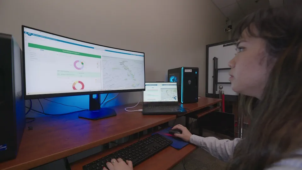
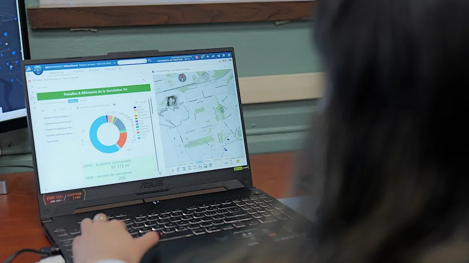
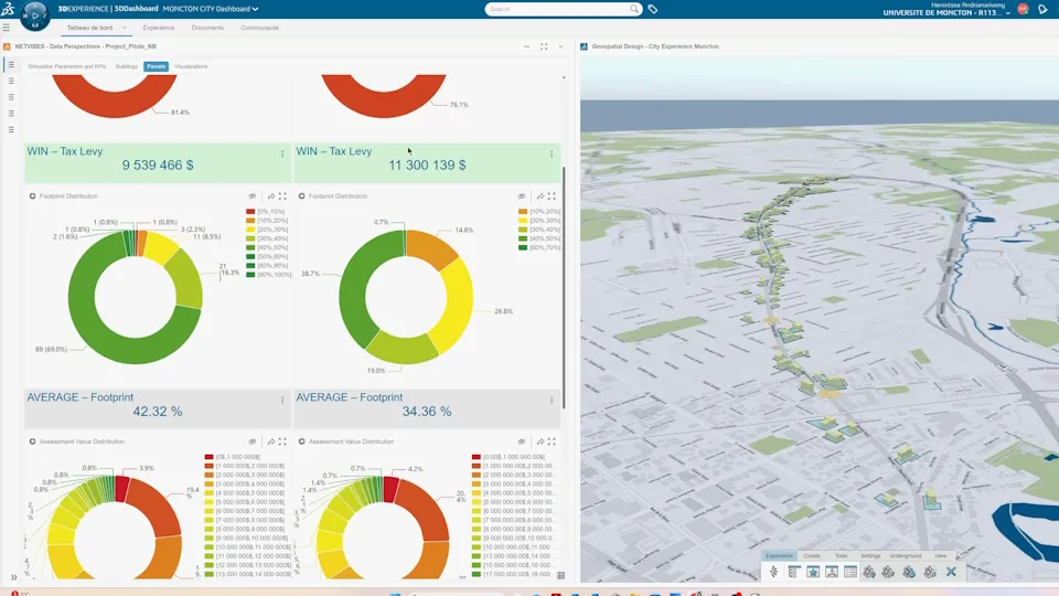
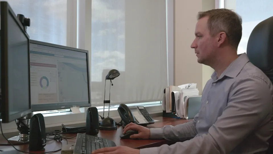
In Moncton and Dieppe, the virtual twin experience is already changing how planners think about growth and density. To make sure the simulations reflected real-world conditions, the group partnered with local mobility specialists like Black Arcs, which led traffic modeling across the different development scenarios. Their analysis challenged long-held planning assumptions about densification and busier roads, revealing that the advised development for Mountain Road would have minimal impact on current traffic levels.
“Denser development allows us to bank more on public transit routes and active transportation, rather than relying on car use,” said Alicia Grayeb, community economic development officer at the City of Moncton. “Simulations like these allow us to run hundreds of different scenarios and choose the better option. That kind of evidence is invaluable when you’re making decisions that will shape the city for decades.”
Being able to visualize these new developments at real scale revealed more insights that might otherwise only emerge once construction begins, particularly around transport systems and noise corridors – zones along busy roads and infrastructure where elevated noise levels influence decisions about building height, setbacks and facade design.
“We want to increase density in the city center while protecting certain areas, for example, where there is a noise corridor,” said Marc-André Cormier, director of engineering at the City of Dieppe. “By modeling these changes, we can see how to make our traffic system more efficient, improve the bus service, and improve access to schools and healthcare.”
“The real-time analysis and scale of the buildings shown on Mountain Road as it exists today reveals that we may need to create bigger parcels of land, or specific lot designs to realize the density we’re aiming for,” Moncton’s Davies added. “This will help us plot our future with much greater confidence.”
What’s particularly powerful is the ability to model how quickly the corridor could deteriorate if development continues unchecked.
Growth planning cannot happen without considering the natural environment. Southeastern New Brunswick sits along a biodiversity corridor across Canada and into the northeastern United States – a connected stretch of land that allows wildlife to move freely across habitats, supporting migration and breeding. This corridor is protected under an international legal agreement and its integrity is essential for species survival.
“If this corridor is not maintained, we risk losing biodiversity,” said Sébastien Doiron, director of Urban Planning at Plan360, Southeast RSC. “Nova Scotia, for example, could lose its moose population entirely; it’s already an endangered species, numbering roughly 500. We need to keep this corridor open to permit different species to migrate and find breeding partners.”
Urban development has already altered significant parts of the corridor since it was last formally studied in 2018. The virtual twin experience enabled the team to replicate and update the study, gaining a clearer picture of what has been lost and what must be protected. Using GEOVIA for terrain and environmental modeling, the team could measure changes in land cover, track the shrinkage of viable habitat patches and assess how fragmentation has affected the connectivity of wildlife routes across the region. In addition, by partnering with forestry intelligence company Remsoft, the team identified corridor opportunities and risks for the best position of a forest bridge over the highway.
“Now, we can better understand how the corridor could change over time, including how fast it could disappear due to development if we don’t intervene,” Doiron said.
“It helps us make a stronger case for densification,” Grayeb added. “By understanding where natural ecosystems must be preserved, we can build the argument for building closer together in urban areas and for the public transit and active transport networks that make that work.”
One of the project’s most significant achievements is changing how organizations work together for the better. The Virtual Twin as a Service serves as a centralized workspace for municipalities, academic institutions, regional bodies and technical partners to share data, align priorities and evaluate options together, breaking down the silos that have traditionally made coordinated regional planning difficult.
“The project has enabled our partners to share their data more effectively and securely, so that they can understand one another better and advocate for their communities,” LeBlanc said.
“It reinforced that collaboration is essential in our region and we can work together towards better shared outcomes,” Grayeb added.
The breadth of the collaboration is illustrated by the involvement of CCNB, which wants to anticipate future housing needs for its students and make sure they have access to affordable accommodation as prices rise across the region.
“The virtual twin experience enabled us to see where our students are located in relation to where affordable housing can be found,” said Ahmed Zniber, manager of the housing department at CCNB. “Visualizing that data in concrete terms was a major asset as we can make sure we always have accommodation available at the right price points.”
Students and researchers at the University of Moncton have been active contributors throughout. They bring their expertise in data science and artificial intelligence (AI) to gather, harmonize, interpret and predict the complex datasets that underpin the virtual twin. Using the 3DEXPERIENCE platform’s built-in AI and data science capabilities, they could process and cross-reference vast volumes of multi-source data and uncover deeper connections between urban growth, mobility, land use and the natural environment.
“In a multidisciplinary project like this, involving engineering, urban planning, biology and ecology, it is important to gather the relevant data, analyze and visualize it, and then find the information buried within it that can’t be found using traditional methods,” Andrianarivony said.
For students, the opportunity to work on a live project of this scale alongside city officials, ecologists and industry partners offers a hands-on learning experience that no classroom can replicate. Translating theoretical knowledge into real decisions, with real consequences, accelerates both technical skills and professional confidence.
“At university, you learn a lot of theoretical aspects,” Andrianarivony said. “This experience allows me to apply that knowledge to real-life projects and societal issues. On a personal level, I developed cross-disciplinary skills that I can carry into my future professional life.”
Public opposition to new development often stems from uncertainty about what a development will look like, how it will affect local residents and whether it will change the character of the area. Through the virtual twin, Moncton and its partners can address that uncertainty directly, turning complex, multi-layered data into something anyone can see, explore and engage with.
"Visual tools like these transform how planning decisions get made and understood,” Davies said. “For the first time, we can show decision-makers exactly what Mountain Road could look like: the opportunities, the constraints and the trade-offs. Seeing it, rather than imagining it, changes the conversation entirely and helps us move far faster than traditional planning methods would allow.”
“Residents want to see the impact of certain developments and now, we can show them before-and-after scenarios for any part of the city,” Cormier added.
The same is true for biodiversity planning, where communicating abstract ecological risks to a broad audience has historically been a challenge. Now, city officials can make a stronger case for protection in a more intuitive and compelling way instead of relying solely on reports and projections.
“Through different data layers and model sets, you can see how habitats connect and trace the exact routes different species depend on for migration,” Doiron said. “These visual indicators help us track changes in land cover such as the loss of vegetation, the encroachment of new buildings and infrastructure, and measure how those elements combine to alter or block the natural pathways. What’s particularly powerful is the ability to model how quickly the corridor could deteriorate if development continues unchecked.”
Ultimately, projects like this demonstrate that the challenges of urban growth are too deeply interconnected to be addressed in isolation. The Virtual Twin as a Service brings them together within a shared view and gives stakeholders the confidence to take action.
“AI and data science are a priority for our university, and our collaboration with Dassault Systèmes shows what can be achieved when academic expertise meets world-class technology and real-world industry experience,” LeBlanc said. “Our goal is to create a center of excellence for virtual twins in territorial development with Dassault Systèmes and make this region a model for others to follow.”

The University of Moncton is Canada’s largest French-language university outside Québec. The university’s three campuses are located in New Brunswick’s francophone regions at Edmundston, Shippagan and Moncton.
Founded in 1963, the University of Moncton offers 165 study programs, including 40 at the master’s degree and doctorate level. Fields of study include administration, arts, education, engineering, forestry, law, nursing, nutrition, psychology, sciences and social work. More than 35 research centers, chairs and institutes are presently active.
For more information: www.umoncton.ca
Design and Deliver sustainable living environment and public services to citizens.
Industry
Discover how Meudon uses Dassault Systèmes’ Virtual Twins to design cooler, climate-resilient spaces with community-driven, science-based urban planning.
Customer Story
Running airflow simulations in the virtual world to prevent virus transmission.
Customer Story
As part of its smart city blueprint, Hong Kong, China government wanted to establish a Common Spatial Data Infrastructure (CSDI). Arup and Dassault Systèmes jointly proposed the 3DEXPERIENCE platform as the foundation of the CSDI to Hong Kong, China’s planning department to optimize smart city operation and management.
Customer Story
Rennes Métropole chooses the 3DEXPERIENCE platform to implement 3DEXPERIENCity Virtual Rennes, a collaborative solution based on the cloud.
Customer Story
The government of Singapore uses Dassault Systèmes’ smart city offer called 3DEXPERIENCity to create a dynamic, 3D digital model of the city and connect all stakeholders in a secure, controlled environment.
Customer Story